 |
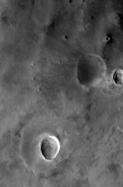
MOC wide-angle image R02-00115
Dust monitor image in northeast Amazonis Planitia
Ancillary data for MOC wide-angle image R02-00115
Acquisition parameters
     Image ID (picno): R02-00115
     Image start time: 2003-02-03T01:19:31.07 SCET
         Image  width:    400      pixels
         Image height:    608      pixels
Line integration time:     80.4800 millisec
   Pixel aspect ratio:      0.82
   Crosstrack summing:      1
    Downtrack summing:      1
     Compression type: MOC-NONE
            Gain mode:     4A (hexadecimal)
          Offset mode:      5 (decimal)
|
Derived values
Longitude of image center: 145.56°W Latitude of image center: 41.45°N Scaled pixel width: 292.56 meters Scaled image width: 117.43 km Scaled image height: 146.69 km Solar longitude (Ls): 132.11° Local True Solar Time: 14.28 decimal hours Emission angle: 22.65° Incidence angle: 37.32° Phase angle: 57.91° North azimuth: 95.96° Sun azimuth: 338.35° Spacecraft altitude: 415.66 km Slant distance: 446.19 km |
Policy regarding use of processed images
Release date: 30 September 2003