 |
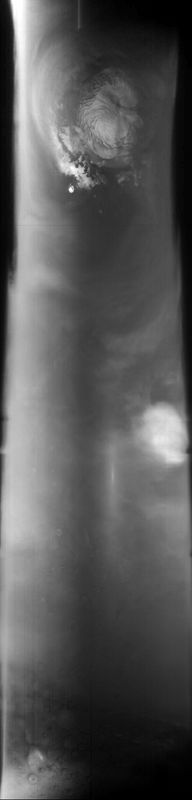
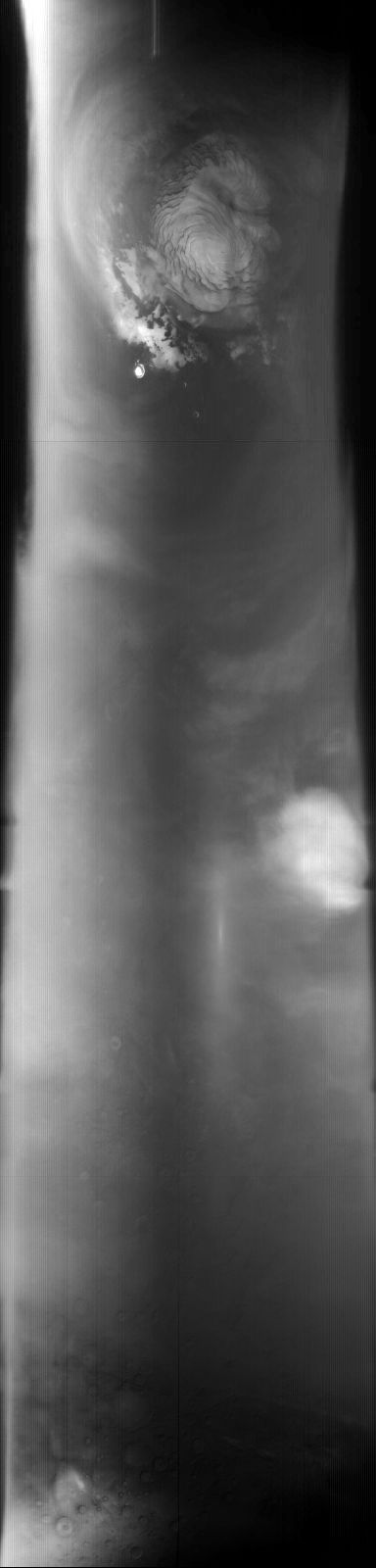
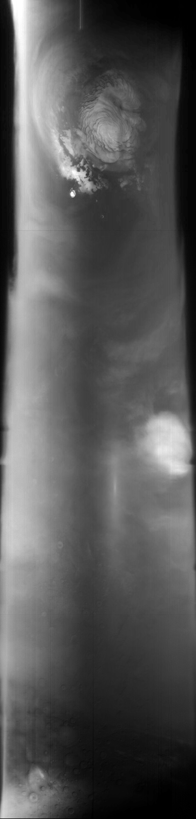
MOC global-map image E21-00360
global map swath
Ancillary data for MOC global-map image E21-00360
Acquisition parameters
     Image ID (picno): E21-00360
     Image start time: 2002-10-07T22:06:51.57 SCET
         Image  width:    384      pixels
         Image height:   1600      pixels
Line integration time:     80.4800 millisec
    Downtrack summing:     27
     Compression type: MOC-DCT-1
            Gain mode:     36 (hexadecimal)
          Offset mode:      5 (decimal)
|
Derived values
Longitude of image center: 159.73°W Latitude of image center: 30.18°N Scaled pixel width: 7280.75 meters Scaled image width: 0.00 km Scaled image height: 10220.87 km Solar longitude (Ls): 78.41° Local True Solar Time: 13.71 decimal hours Emission angle: 17.43° Incidence angle: 29.53° Phase angle: 33.77° North azimuth: 94.05° Sun azimuth: 1.30° Spacecraft altitude: 408.09 km Slant distance: 425.48 km |
Policy regarding use of processed images
Release date: 30 September 2003