 |
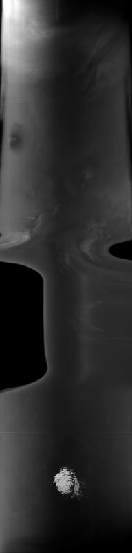
MOC global-map image R11-03207
global map swath
Ancillary data for MOC global-map image R11-03207
Acquisition parameters
     Image ID (picno): R11-03207
     Image start time: 2003-11-19T16:51:47.39 SCET
         Image  width:    384      pixels
         Image height:   1600      pixels
Line integration time:     80.4800 millisec
    Downtrack summing:     27
     Compression type: MOC-NONE
            Gain mode:     76 (hexadecimal)
          Offset mode:      5 (decimal)
|
Derived values
Longitude of image center: 110.27°W Latitude of image center: 20.60°S Scaled pixel width: 7234.09 meters Scaled image width: 169.28 km Scaled image height: 10333.88 km Solar longitude (Ls): 301.48° Local True Solar Time: 13.03 decimal hours Emission angle: 19.34° Incidence angle: 21.04° Phase angle: 40.36° North azimuth: 92.29° Sun azimuth: 356.39° Spacecraft altitude: 376.95 km Slant distance: 397.06 km |
Policy regarding use of processed images
Release date: 27 September 2004