 |
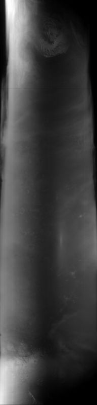
MOC global-map image R03-00975
global map swath
Ancillary data for MOC global-map image R03-00975
Acquisition parameters
     Image ID (picno): R03-00975
     Image start time: 2003-03-19T17:44:25.32 SCET
         Image  width:    384      pixels
         Image height:   1600      pixels
Line integration time:     80.4800 millisec
    Downtrack summing:     27
     Compression type: MOC-DCT-1
            Gain mode:     46 (hexadecimal)
          Offset mode:      5 (decimal)
|
Derived values
Longitude of image center: 324.23°W Latitude of image center: 16.00°N Scaled pixel width: 7092.24 meters Scaled image width: 0.00 km Scaled image height: 10397.89 km Solar longitude (Ls): 154.51° Local True Solar Time: 14.21 decimal hours Emission angle: 17.41° Incidence angle: 39.55° Phase angle: 42.62° North azimuth: 93.74° Sun azimuth: 0.99° Spacecraft altitude: 396.57 km Slant distance: 413.48 km |
Policy regarding use of processed images
Release date: 20 April 2004