 |
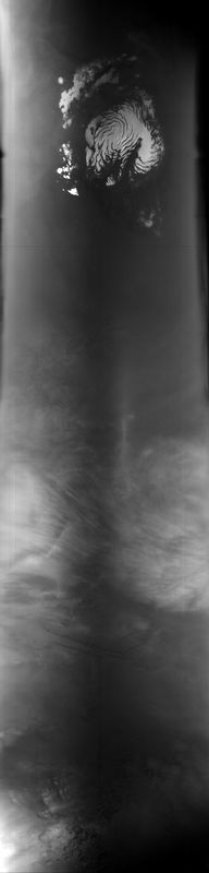
MOC global-map image M23-01821
global map swath
Ancillary data for MOC global-map image M23-01821
Acquisition parameters
     Image ID (picno): M23-01821
     Image start time: 2001-01-28T02:51:11.46 SCET
         Image  width:    384      pixels
         Image height:   1600      pixels
Line integration time:     80.4800 millisec
    Downtrack summing:     27
     Compression type: MOC-DCT-1
            Gain mode:     46 (hexadecimal)
          Offset mode:      5 (decimal)
|
Derived values
Longitude of image center: 62.95°W Latitude of image center: 29.73°N Scaled pixel width: 6912.78 meters Scaled image width: 0.00 km Scaled image height: 10238.35 km Solar longitude (Ls): 109.15° Local True Solar Time: 13.78 decimal hours Emission angle: 0.53° Incidence angle: 30.71° Phase angle: 30.82° North azimuth: 93.44° Sun azimuth: 0.29° Spacecraft altitude: 404.87 km Slant distance: 404.88 km |
Policy regarding use of processed images
Release date: 8 October 2001