 |
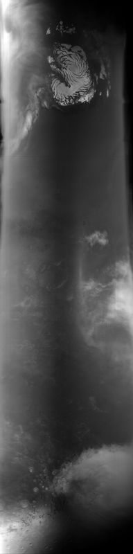
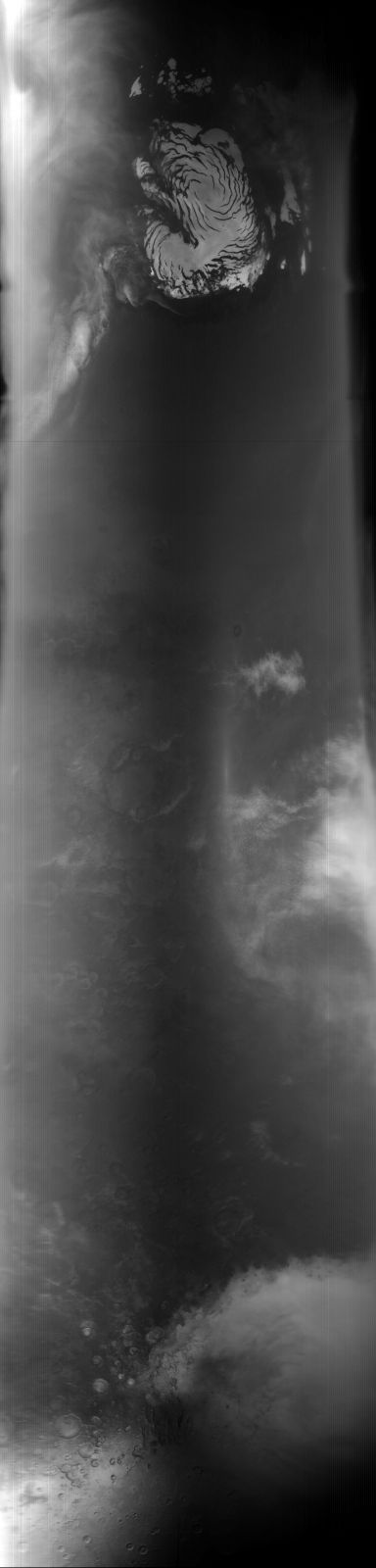
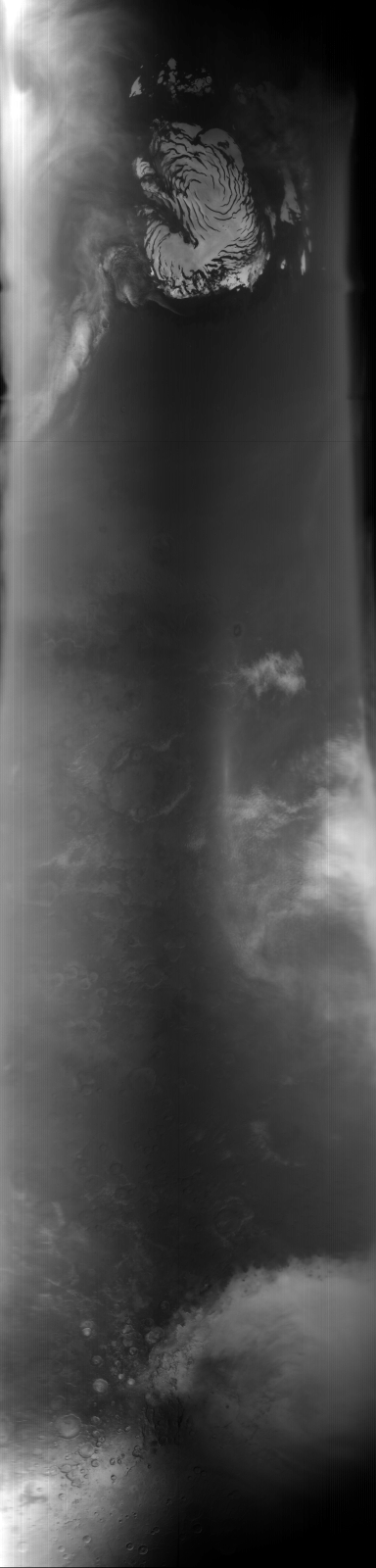
MOC global-map image E02-01226
global map swath
Ancillary data for MOC global-map image E02-01226
Acquisition parameters
     Image ID (picno): E02-01226
     Image start time: 2001-03-15T01:37:07.66 SCET
         Image  width:    384      pixels
         Image height:   1600      pixels
Line integration time:     80.4800 millisec
    Downtrack summing:     27
     Compression type: MOC-NONE
            Gain mode:     56 (hexadecimal)
          Offset mode:      5 (decimal)
|
Derived values
Longitude of image center: 321.50°W Latitude of image center: 24.67°N Scaled pixel width: 6913.08 meters Scaled image width: 0.00 km Scaled image height: 10291.73 km Solar longitude (Ls): 130.65° Local True Solar Time: 13.91 decimal hours Emission angle: 0.58° Incidence angle: 33.63° Phase angle: 33.62° North azimuth: 93.27° Sun azimuth: 0.46° Spacecraft altitude: 404.53 km Slant distance: 404.55 km |
Policy regarding use of processed images
Release date: 7 May 2002